Transform overlapping 2D images into precise 3D models and measurements with our advanced photogrammetry solutions.
Traditional surveying methods are time-consuming, expensive, and often lack the detail needed for modern applications. Photogrammetry offers a cost-effective way to capture complex reality and extract precise measurements from imagery.
Capturing complex 3D environments with traditional methods is slow and expensive
Advanced photogrammetry algorithms transform images into accurate 3D data
Create detailed 3D models from standard 2D photographs with millimeter accuracy.
Extract accurate distances, areas, and volumes without physical contact.
Cloud-based processing delivers results in hours instead of weeks.
Reduce survey costs by up to 70% compared to traditional methods.
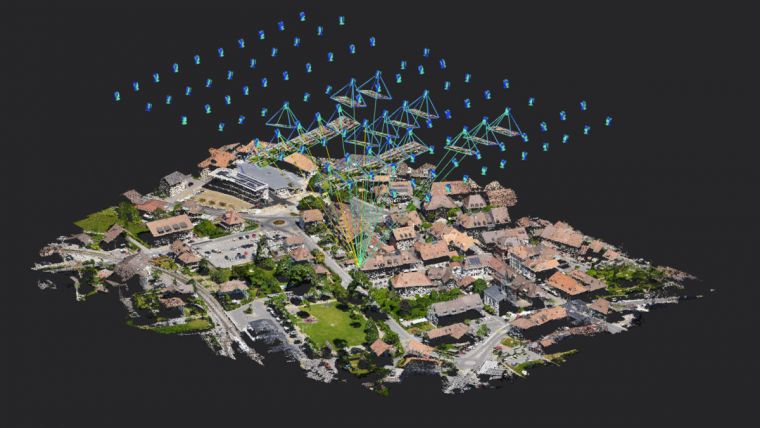
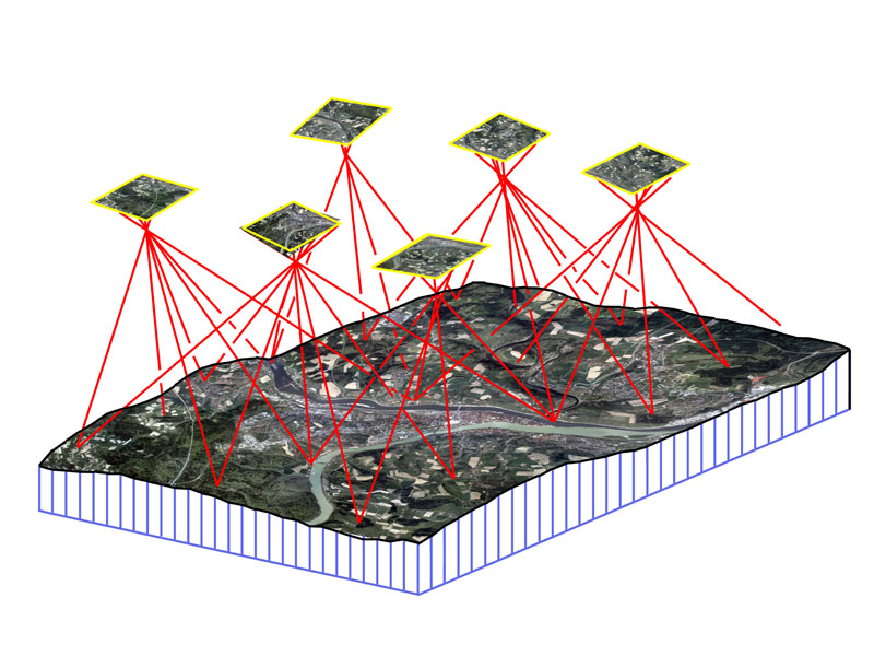
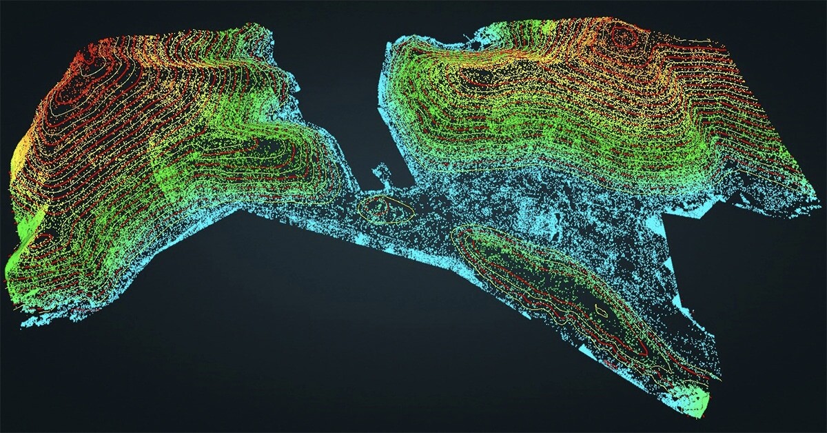
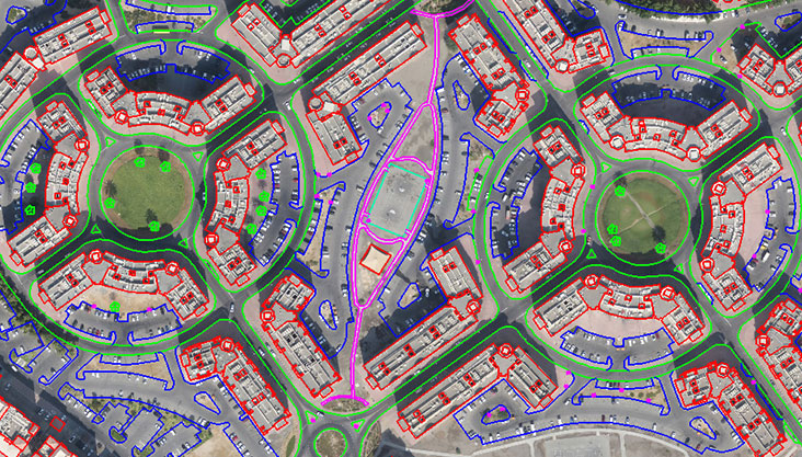
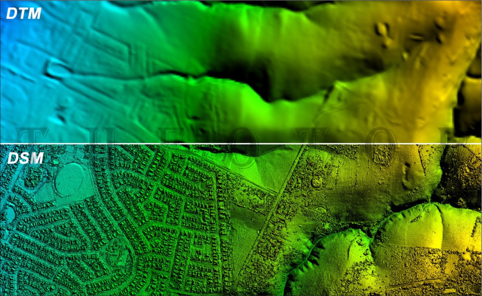
Atlas Geotech offers comprehensive aerial photogrammetry mapping services to transform aerial photographs into accurate and detailed 3D models, maps, and technical drawings of terrain and physical objects. Using advanced soft copy stereo photogrammetric technology, our team of certified photogrammetrists captures data from stereo models to produce high-precision digital topographic maps.
Our digital photogrammetry services deliver precise mapping outputs for diverse applications. From large-scale topographic mapping to thematic layers like land use, geology, and vegetation, we ensure accurate base data for urban planning, infrastructure development, and environmental monitoring.
Using advanced stereo-plotting techniques, we extract 3D features with exceptional clarity. Buildings, roads, rivers, utilities, and vegetation are mapped with high accuracy, creating detailed vector datasets that support engineering, GIS analysis, and infrastructure planning.
Accurate aerial triangulation ensures precise orientation and alignment of aerial photo blocks. By establishing ground control points (GCPs) and refining block adjustments, we guarantee reliable mapping foundations and seamless orthophoto generation.
We transform raw elevation data into detailed contour maps and topographic profiles, supporting civil engineering and hydrological studies. From watershed and drainage analysis to infrastructure planning, our contour generation services bring terrain to life with precision.
Our mapping services combine precise planimetric features such as roads, railways, water bodies, and buildings with topographic elements including elevations, slope maps, and hillshades. This results in comprehensive maps ready for GIS integration and decision-making.
We create realistic 3D city models from aerial imagery, capturing building footprints, heights, and structural details. These models support urban simulations, visibility studies, solar potential analysis, and flood risk modelling—empowering smart city planning.
From bare-earth Digital Terrain Models (DTM) to Digital Surface Models (DSM) that include vegetation and structures, we provide high-resolution elevation data for hydrology, flood risk studies, and infrastructure design projects.
Overlapping images from drones or cameras
Secure transfer to processing servers
Point cloud generation and mesh creation
Applying high-quality textures from images
Multiple formats for various applications
As-built documentation, progress monitoring, and BIM integration for construction projects.
Stockpile volumetrics, site planning, and cut/fill calculations for mining operations.
Canopy height models, biomass estimation, and crop health monitoring.
Crime scene documentation, accident reconstruction, and evidence preservation.
Preservation, restoration, and virtual access to historical sites and artifacts.
3D assets for games, virtual production, and visual effects in film and television.
We deliver exceptional results by combining unparalleled expertise with cutting-edge technology and a client-focused approach.
Our certified photogrammetrists ensure every measurement is precise, creating highly reliable maps and models.
From data acquisition to final delivery, our streamlined process guarantees efficiency without compromising quality.
Receive your final products in any format, including CAD and GIS, for easy integration into your existing systems.
Parameter | Standard | Professional | Enterprise |
---|---|---|---|
Maximum Images | 500 images | 2,000 images | Unlimited |
Output Resolution | Medium (5M faces) | High (20M faces) | Ultra (50M+ faces) |
Accuracy | 1-3 cm GSD | 0.5-1 cm GSD | 0.1-0.5 cm GSD |
Processing Time | 24-48 hours | 12-24 hours | 4-12 hours |
Cloud Processing | ✓ | ✓ | ✓ (Priority) |
Output Formats | OBJ, FBX | OBJ, FBX, GLTF | All standard formats |
API Access | - | ✓ | ✓ (Full access) |
Transform your images into accurate 3D models with our advanced photogrammetry processing pipeline.